.png)
A Story About Land Access And Protection
THE Keweenaw Point Trail
At the edge of Michigan’s Keweenaw Peninsula, the Keweenaw Point Trail (KPT) does more than stretch toward the tip of the peninsula; it tells the story of how Copper Harbor became what it is today. The Point Trail is a lens into the bigger picture: the evolution of accessible and sustainable trails in the Keweenaw, the decades of land acquisition that made public access possible, and the community effort behind every mile of trail. And the wildest part? We still aren’t done.
When completed, the KPT will span roughly 30 miles and weave across state forest, state park, and East Bluff Bike Park property, pushing deeper into the tip of the Keweenaw Peninsula than any other trail. It travels across ancient bedrock, through boreal forest, and into terrain that feels untouched, remote, and genuinely backcountry. The vision was simple but bold: build a continuous route that captures the raw spirit of the Keweenaw, a ride that reminds you why you fell in love with this place in the first place.
But the KPT isn’t just a trail. It’s the product of more than a decade of community work: thousands of volunteer hours, unwavering donor support, and expert craftsmanship from Rock Solid Trail Contracting. Every segment carries its own history of access secured, permits earned, partnerships forged, and a community refusing to settle for temporary or fragile trail connections.
In every way, the Point Trail shows what’s possible when a community builds not just for today, but for decades to come. It cements Copper Harbor as a premiere outdoor recreation destination, and stands as one of the most ambitious, meaningful trail projects ever undertaken in the Upper Peninsula.
The KPT matters because it’s more than dirt and rock. It represents:
ACCESS
to some of the most remote and breathtaking shorelines in the Keweenaw.
SUSTAINABILITY
, with world-class design that protects fragile ecosystems.
ECONOMIC IMPACT
, keeping our small community thriving year-round.
LEGACY
, creating long-term, permanent public access built for future generations.
The Keweenaw Point Trail is over a decade-long effort made possible by volunteers, donors, trail crews, partners, and supporters who believe deeply in what we’re building here. Every phase tells a story. Every mile reveals a new, untouched corner of the Keweenaw. And every ride reminds us why this work matters.
2002
THE LAND DEAL THAT STARTED EVERYTHING
Over 6,300 acres at Keweenaw Point, including nine miles of undeveloped Lake Superior shoreline, were at risk of sale by a timber investment firm. The Nature Conservancy stepped in as a bridge buyer, buying just enough time for the State of Michigan to acquire the land and lock it into public stewardship forever.
2004-2008
The vision takes shape
The DNR gathered a Citizens' Advisory Committee — local riders, conservationists, community members — who drew the first blueprint: a non-motorized corridor from Copper Harbor to the tip of the peninsula. Volunteers were already cutting singletrack before the Copper Harbor Trails Club even became a nonprofit in 2008.
2014
Manganese Rd → Mud Lake
The first section broke ground in May 2014. Crews jackhammered through volcanic bedrock and built a cedar-swamp boardwalk longer than anything attempted before. The terrain was savage. The ambition matched it.
2016-2017
MANDAN → HIGH ROCK
Phase 2 had one goal: get to High Rock. The trail pushed east through deep backcountry forest before spilling onto the Lake Superior shoreline — terrain that took landowner negotiations and no small amount of behind-the-scenes work to reach. By summer 2017, it was done.
2019
SUMMER SCHOOL
Built as a training project for Rock Solid employees, this trail developed builder skillsets while adding an important connector to the growing network.
2020 – 2021
EAST BLUFF → MANDAN
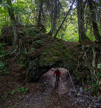
Construction on the East Bluff to Mandan corridor began in 2020 and continued through 2021. Riders quickly fell in love with the arched log bridge over Union Creek—a creative landmark that became a symbol of how artful this kind of work can be.
2023
Mud Lake → East Bluff
Facilitated by KORC and ultimately secured by the DNR, this land purchase became the breakthrough that made the next phase of the Point Trail possible. This acquisition connected the start of the Point Trail and Manganese Road all the way to High Rock Bay, tying together years of progress. For the first time, riders could move seamlessly between Manganese, Mud Lake, and East Bluff, unlocking the possibility of a true full-day backcountry loop.
2023
KEYSTONE
The 2023 build season carried crews through the 2006 burn zone on the way to Keystone Bay. The terrain was raw and dramatic, with exposed rock, open views, and technical features that gave the trail a new identity.
2025-2026
FISH COVE
Materials hauled in by boat. Long boardwalks through wetlands. Strict environmental protocols. Phase 3.2 pushed into some of the most technically demanding terrain yet, delivering a corridor that includes the Sea Arch and open Lake Superior vistas that feel genuinely untouched.
2026
MONTREAL FALLS
As 2026 draws to a close, the project enters its most ambitious phase: the Montreal Corridor. This section will create the first sustainable, purpose-built, permanent access to both the Upper and Lower Montreal Falls. It's the most ecologically sensitive stretch of the entire route. Getting it right meant years of corridor flagging, endangered plant surveys, careful rerouting, and close collaboration with the DNR, EGLE, and Schubbe Consulting.

Views of Keystone Bay along the Keweenaw Point Trail